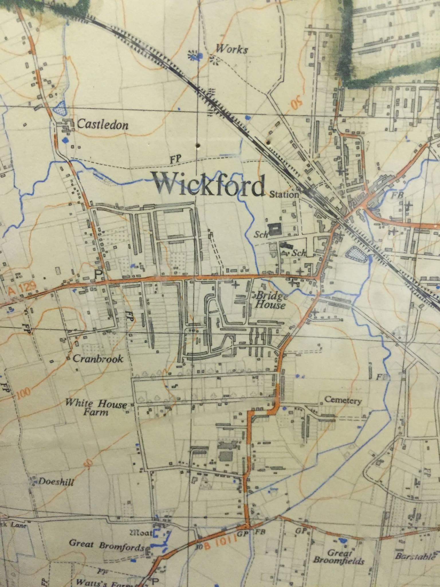
I was using the railway station and roads to Wantz Corner in the 40s and 50s, and it seemed that there were more buildings along the way than shown on the map.
By Lorraine Taylor (21/01/2018)
It must date from after 1937 when the Wickford Market Road school was built. Somewhere about 1940 or 1950.
By stephen winfield (12/01/2018)
This map shows Margarite Way and Elizabeth Drive completed.
I lived in Margarite Way from 1953 to 1959. The builder was still building Margarite Way and the west end of Elizabeth Driven when we moved in, in 1953. I would date this map to 1955.
By Martin Bishop (21/06/2017)
This looks late 1930s, as it shows the Louvaine and Victoria roads off London Road. My parents, who came down from London about 1936, said these bungalows that Carter and Ward were building in this area were £200 but there was a £25 deposit needed, which in those days, with wages being about £2 or £3 a week, was a dream.
")


Comments about this page
Add your own comment
I was using the railway station and roads to Wantz Corner in the 40s and 50s, and it seemed that there were more buildings along the way than shown on the map.
It must date from after 1937 when the Wickford Market Road school was built. Somewhere about 1940 or 1950.
This map shows Margarite Way and Elizabeth Drive completed.
I lived in Margarite Way from 1953 to 1959. The builder was still building Margarite Way and the west end of Elizabeth Driven when we moved in, in 1953. I would date this map to 1955.
This looks late 1930s, as it shows the Louvaine and Victoria roads off London Road. My parents, who came down from London about 1936, said these bungalows that Carter and Ward were building in this area were £200 but there was a £25 deposit needed, which in those days, with wages being about £2 or £3 a week, was a dream.
Add a comment about this page