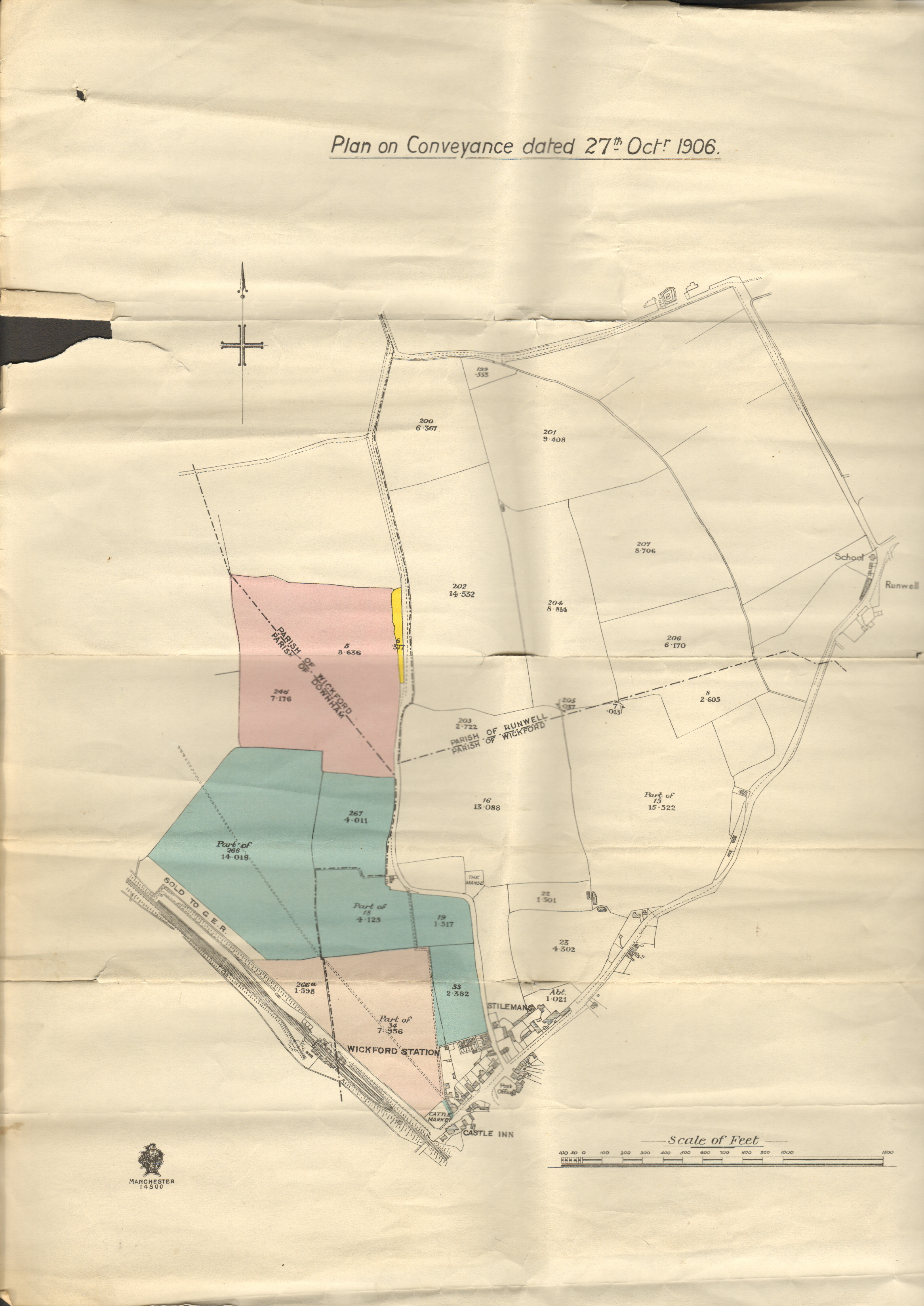
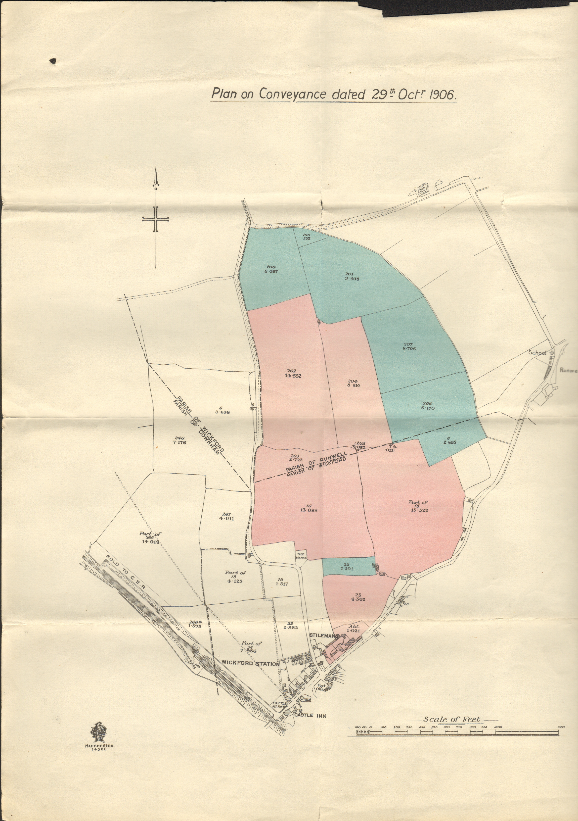
These conveyance maps show the areas which would become the Wickford Garden Village in 1909.
The first map, dated 27th October, shows the area bounded by the railway line to the west and by Swan Lane to the east. This area is in two parishes, Wickford and Downham.
The second map, dated 29th October, shows the area bounded by Swan Lane to the west, Church End Lane to the north and the Broadway and Runwell Road to the south. Again this area falls into two parishes, this time Wickford and Runwell.
The maps also show the position of houses and businesses at the time. Wickford Station, the Cattle Market, the Castle Inn, Stilemans Farm, the Manse on Swan Lane and Runwell School opposite St Mary’s church are all highlighted.


Comments about this page
Add your own comment
DID you know that when Wickford and Runwell was planned Waverly Crescent, Linden Road, and Downham road, came under the title of Station Estate? Bit far away don’t you think?,,,,
I’m not sure whether village or town status is granted to a place. I guess that once a village achieves a population of 3000 that would denote a town as opposed to a village assuming that the place has basic facilities like a retail street etc. On that basis town status would have occurred circa 1930 I’d have thought. As a child in the 1960s we had an elderly lady – Mrs Archer who lived in Apple Tree Way on the Highcliffe estate, come in and do some cleaning. She always referred to Wickford High Street as the village.
I happen to live in one of the pink areas in the second map. I’m intrigued to see that this area was called a “village”. Does anyone know when Wickford became a town?
Add a comment about this page